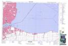
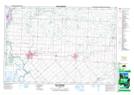
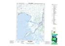
Maps showing Lac Sainte-Claire, Essex; Kent, Ontario
Lac Sainte-Claire is a Lake located in Essex; Kent, Ontario and has an elevation of 175 meters.
- Latitude: 42° 28' North (decimal: 42.4666999)
- Longitude: 82° 40' West (decimal: -82.6667000)
- Topography Feature Category: Lake
- Geographical Feature: Lac
- Canadian Province/Territory: Ontario
- Elevation: 175 meters
- Location: Essex; Kent
- Atlas of Canada Locator Map: Lac Sainte-Claire
- GPS Coordinate Locator Map: Lac Sainte-Claire Lat/Long
Lac Sainte-Claire NTS Map Sheets