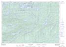
Maps showing Baie Fine, Manitoulin, Ontario
Baie Fine is a Bay located in Manitoulin, Ontario and has an elevation of 217 meters.
- Latitude: 46° 1' 41'' North (decimal: 46.0280555)
- Longitude: 81° 33' 33'' West (decimal: -81.5591666)
- Topography Feature Category: Bay
- Geographical Feature: Baie
- Canadian Province/Territory: Ontario
- Elevation: 217 meters
- Location: Manitoulin
- Atlas of Canada Locator Map: Baie Fine
- GPS Coordinate Locator Map: Baie Fine Lat/Long
Baie Fine NTS Map Sheets