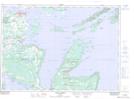
Maps showing Fisher Harbour, Manitoulin, Ontario
Fisher Harbour is a Marine navigation feature located in Manitoulin, Ontario and has an elevation of 178 meters.
- Latitude: 45° 59' 46'' North (decimal: 45.9961111)
- Longitude: 81° 44' 14'' West (decimal: -81.7372222)
- Topography Feature Category: Marine navigation feature
- Geographical Feature: Harbour
- Canadian Province/Territory: Ontario
- Elevation: 178 meters
- Location: Manitoulin
- Atlas of Canada Locator Map: Fisher Harbour
- GPS Coordinate Locator Map: Fisher Harbour Lat/Long
Fisher Harbour NTS Map Sheets