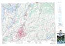
Maps showing Morrow Point, Northumberland, Ontario
Morrow Point is a Cape located in Northumberland, Ontario and has an elevation of 209 meters.
- Latitude: 44° 15' 48'' North (decimal: 44.2633333)
- Longitude: 78° 2' 23'' West (decimal: -78.0397222)
- Topography Feature Category: Cape
- Geographical Feature: Point
- Canadian Province/Territory: Ontario
- Elevation: 209 meters
- Location: Northumberland
- Atlas of Canada Locator Map: Morrow Point
- GPS Coordinate Locator Map: Morrow Point Lat/Long
Morrow Point NTS Map Sheets