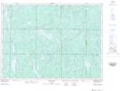
Maps showing Claw Creek Bay, Sudbury, Ontario
Claw Creek Bay is a Bay located in Sudbury, Ontario and has an elevation of 342 meters.
- Latitude: 47° 41' 12'' North (decimal: 47.6866666)
- Longitude: 81° 27' 29'' West (decimal: -81.4580555)
- Topography Feature Category: Bay
- Geographical Feature: Bay
- Canadian Province/Territory: Ontario
- Elevation: 342 meters
- Location: Sudbury
- Atlas of Canada Locator Map: Claw Creek Bay
- GPS Coordinate Locator Map: Claw Creek Bay Lat/Long
Claw Creek Bay NTS Map Sheets