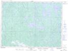
Maps showing East Arm, Sudbury, Ontario
East Arm is a Bay located in Sudbury, Ontario and has an elevation of 382 meters.
- Latitude: 47° 36' 31'' North (decimal: 47.6086111)
- Longitude: 82° 10' 37'' West (decimal: -82.1769444)
- Topography Feature Category: Bay
- Geographical Feature: Arm
- Canadian Province/Territory: Ontario
- Elevation: 382 meters
- Location: Sudbury
- Atlas of Canada Locator Map: East Arm
- GPS Coordinate Locator Map: East Arm Lat/Long
East Arm NTS Map Sheets