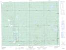
Maps showing Esker Lakes Provincial Park, Cochrane, Ontario
Esker Lakes Provincial Park is a Conservation area located in Cochrane, Ontario and has an elevation of 338 meters.
- Latitude: 48° 19' 13'' North (decimal: 48.3202777)
- Longitude: 79° 52' 39'' West (decimal: -79.8775000)
- Topography Feature Category: Conservation area
- Geographical Feature: Provincial Park
- Canadian Province/Territory: Ontario
- Elevation: 338 meters
- Location: Cochrane
- Atlas of Canada Locator Map: Esker Lakes Provincial Park
- GPS Coordinate Locator Map: Esker Lakes Provincial Park Lat/Long
Esker Lakes Provincial Park NTS Map Sheets