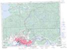
Maps showing Dennis, Algoma, Ontario
Dennis is a Geographical area located in Algoma, Ontario.
- Latitude: 46° 38' 2'' North (decimal: 46.6338888)
- Longitude: 84° 29' 40'' West (decimal: -84.4944444)
- Topography Feature Category: Geographical area
- Geographical Feature: Geographic Township
- Canadian Province/Territory: Ontario
- Location: Algoma
- Atlas of Canada Locator Map: Dennis
- GPS Coordinate Locator Map: Dennis Lat/Long
Dennis NTS Map Sheets