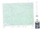
Maps showing Deux-Rivières, Renfrew, Ontario
Deux-Rivières is a Unincorporated area located in Renfrew, Ontario and has an elevation of 173 meters.
- Latitude: 46° 14' 57'' North (decimal: 46.2491666)
- Longitude: 78° 17' 36'' West (decimal: -78.2933333)
- Topography Feature Category: Unincorporated area
- Geographical Feature: Compact Rural Community
- Canadian Province/Territory: Ontario
- Elevation: 173 meters
- Location: Renfrew
- Atlas of Canada Locator Map: Deux-Rivières
- GPS Coordinate Locator Map: Deux-Rivières Lat/Long
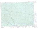
Deux-Rivières NTS Map Sheets