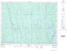
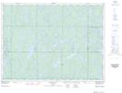
Maps showing Mattagami, Sudbury, Ontario
Mattagami is a Geographical area located in Sudbury, Ontario and has an elevation of 334 meters.
- Latitude: 47° 48' 4'' North (decimal: 47.8011111)
- Longitude: 81° 31' 30'' West (decimal: -81.5250000)
- Topography Feature Category: Geographical area
- Geographical Feature: Geographic Township
- Canadian Province/Territory: Ontario
- Elevation: 334 meters
- Location: Sudbury
- Atlas of Canada Locator Map: Mattagami
- GPS Coordinate Locator Map: Mattagami Lat/Long
Mattagami NTS Map Sheets