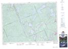
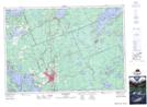
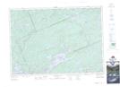
Maps showing Ridout, Muskoka, Ontario
Ridout is a Geographical area located in Muskoka, Ontario.
- Latitude: 45° 11' 5'' North (decimal: 45.1847000)
- Longitude: 78° 56' 59'' West (decimal: -78.9496999)
- Topography Feature Category: Geographical area
- Geographical Feature: Geographic Township
- Canadian Province/Territory: Ontario
- Location: Muskoka
- Atlas of Canada Locator Map: Ridout
- GPS Coordinate Locator Map: Ridout Lat/Long
Ridout NTS Map Sheets