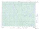
Maps showing Bass Lake, Sudbury, Ontario
Bass Lake is a Lake located in Sudbury, Ontario and has an elevation of 404 meters.
- Latitude: 46° 54' 38'' North (decimal: 46.9105555)
- Longitude: 81° 47' 49'' West (decimal: -81.7969444)
- Topography Feature Category: Lake
- Geographical Feature: Lake
- Canadian Province/Territory: Ontario
- Elevation: 404 meters
- Location: Sudbury
- Atlas of Canada Locator Map: Bass Lake
- GPS Coordinate Locator Map: Bass Lake Lat/Long