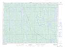
Maps showing Stoney Bay, Sudbury, Ontario
Stoney Bay is a Bay located in Sudbury, Ontario and has an elevation of 400 meters.
- Latitude: 46° 52' 30'' North (decimal: 46.8750000)
- Longitude: 81° 47' 6'' West (decimal: -81.7850000)
- Topography Feature Category: Bay
- Geographical Feature: Bay
- Canadian Province/Territory: Ontario
- Elevation: 400 meters
- Location: Sudbury
- Atlas of Canada Locator Map: Stoney Bay
- GPS Coordinate Locator Map: Stoney Bay Lat/Long