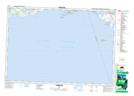
Maps showing Cramahe, Northumberland, Ontario
Cramahe is a Other municipal/district area - miscellaneous located in Northumberland, Ontario.
- Latitude: 44° 5' 12'' North (decimal: 44.0866666)
- Longitude: 77° 52' 38'' West (decimal: -77.8772222)
- Topography Feature Category: Other municipal/district area - miscellaneous
- Geographical Feature: Township Municipality
- Canadian Province/Territory: Ontario
- Location: Northumberland
- Atlas of Canada Locator Map: Cramahe
- GPS Coordinate Locator Map: Cramahe Lat/Long
Cramahe NTS Map Sheets