Canada Topographic Maps

Montague Topo Maps

Topography maps and Latitude/Longitude Location

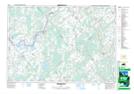
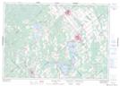
Maps showing Montague, Lanark, Ontario

Montague is a Other municipal/district area - miscellaneous located in Lanark, Ontario.

  • Latitude: 44° 58' 59'' North   (decimal: 44.9830555)
  • Longitude: 75° 58' 56'' West   (decimal: -75.9822222)
  • Topography Feature Category: Other municipal/district area - miscellaneous
  • Geographical Feature: Township Municipality
  • Canadian Province/Territory: Ontario
  • Location: Lanark
  • Atlas of Canada Locator Map: Montague
  • GPS Coordinate Locator Map: Montague Lat/Long

Montague NTS Map Sheets

031B13 Merrickville Topographic Map at 1:50,000 scale

031C16 Perth Topographic Map at 1:50,000 scale

031F01 Carleton Place Topographic Map at 1:50,000 scale

031G04 Kemptville Topographic Map at 1:50,000 scale

031B Ogdensburg Topographic Map at 1:250,000 scale

031C Kingston Topographic Map at 1:250,000 scale

031F Pembroke Topographic Map at 1:250,000 scale

031G Ottawa Topographic Map at 1:250,000 scale

 
Buy Topographic Maps DVD
Newsletter Sign-up

Yes, I want to receive map store discounts.


Bookmark and Share