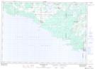
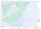
Maps showing Tehkummah, Manitoulin, Ontario
Tehkummah is a Other municipal/district area - miscellaneous located in Manitoulin, Ontario.
- Latitude: 45° 37' 56'' North (decimal: 45.6322222)
- Longitude: 82° 2' 49'' West (decimal: -82.0469444)
- Topography Feature Category: Other municipal/district area - miscellaneous
- Geographical Feature: Township Municipality
- Canadian Province/Territory: Ontario
- Location: Manitoulin
- Atlas of Canada Locator Map: Tehkummah
- GPS Coordinate Locator Map: Tehkummah Lat/Long
Tehkummah NTS Map Sheets