Canada Topographic Maps

The Archipelago Topo Maps

Topography maps and Latitude/Longitude Location

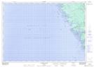
Maps showing The Archipelago, Parry Sound, Ontario

The Archipelago is a Other municipal/district area - miscellaneous located in Parry Sound, Ontario.

  • Latitude: 45° 34' 58'' North   (decimal: 45.5827777)
  • Longitude: 80° 22' 55'' West   (decimal: -80.3819444)
  • Topography Feature Category: Other municipal/district area - miscellaneous
  • Geographical Feature: Township Municipality
  • Canadian Province/Territory: Ontario
  • Location: Parry Sound
  • Atlas of Canada Locator Map: The Archipelago
  • GPS Coordinate Locator Map: The Archipelago Lat/Long

The Archipelago NTS Map Sheets

031E04 Lake Joseph Topographic Map at 1:50,000 scale

031E05 Orrville Topographic Map at 1:50,000 scale

041H01 Sans Souci Topographic Map at 1:50,000 scale

041H08 Parry Sound Topographic Map at 1:50,000 scale

041H09 Pointe Au Baril Station Topographic Map at 1:50,000 scale

041H10 Naiscoot River Topographic Map at 1:50,000 scale

031E Huntsville Topographic Map at 1:250,000 scale

041H Tobermory Topographic Map at 1:250,000 scale

 
Buy Topographic Maps DVD
Newsletter Sign-up

Yes, I want to receive map store discounts.


Bookmark and Share