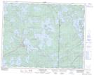
Maps showing Poplar Narrows, Kenora, Ontario
Poplar Narrows is a Channel located in Kenora, Ontario and has an elevation of 302 meters.
- Latitude: 50° 8' 37'' North (decimal: 50.1436111)
- Longitude: 95° 1' 33'' West (decimal: -95.0258333)
- Topography Feature Category: Channel
- Geographical Feature: Narrows
- Canadian Province/Territory: Ontario
- Elevation: 302 meters
- Location: Kenora
- Atlas of Canada Locator Map: Poplar Narrows
- GPS Coordinate Locator Map: Poplar Narrows Lat/Long
Poplar Narrows NTS Map Sheets