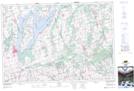
Maps showing Port Hoover, Ontario
Port Hoover is a Unincorporated area located in Ontario.
- Latitude: 44° 14' North (decimal: 44.2333000)
- Longitude: 78° 55' West (decimal: -78.9167000)
- Topography Feature Category: Unincorporated area
- Geographical Feature: Post Office
- Canadian Province/Territory: Ontario
- Atlas of Canada Locator Map: Port Hoover
- GPS Coordinate Locator Map: Port Hoover Lat/Long