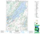
Maps showing Poverty Island Lower Shoal, Leeds, Ontario
Poverty Island Lower Shoal is a Shoal located in Leeds, Ontario.
- Latitude: 44° 24' 6'' North (decimal: 44.4016666)
- Longitude: 75° 51' 50'' West (decimal: -75.8638888)
- Topography Feature Category: Shoal
- Geographical Feature: Shoal
- Canadian Province/Territory: Ontario
- Location: Leeds
- Atlas of Canada Locator Map: Poverty Island Lower Shoal
- GPS Coordinate Locator Map: Poverty Island Lower Shoal Lat/Long
Poverty Island Lower Shoal NTS Map Sheets