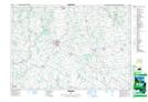
Maps showing Purvis Lake, Bruce, Ontario
Purvis Lake is a Lake located in Bruce, Ontario and has an elevation of 304 meters.
- Latitude: 43° 57' 6'' North (decimal: 43.9516666)
- Longitude: 81° 28' 24'' West (decimal: -81.4733333)
- Topography Feature Category: Lake
- Geographical Feature: Lake
- Canadian Province/Territory: Ontario
- Elevation: 304 meters
- Location: Bruce
- Atlas of Canada Locator Map: Purvis Lake
- GPS Coordinate Locator Map: Purvis Lake Lat/Long