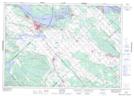
Maps showing Rafting Point, Renfrew, Ontario
Rafting Point is a Cape located in Renfrew, Ontario and has an elevation of 79 meters.
- Latitude: 45° 26' 34'' North (decimal: 45.4427777)
- Longitude: 76° 20' 49'' West (decimal: -76.3469444)
- Topography Feature Category: Cape
- Geographical Feature: Point
- Canadian Province/Territory: Ontario
- Elevation: 79 meters
- Location: Renfrew
- Atlas of Canada Locator Map: Rafting Point
- GPS Coordinate Locator Map: Rafting Point Lat/Long