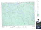
Maps showing Lake St. Peter, Hastings, Ontario
Lake St. Peter is a Unincorporated area located in Hastings, Ontario and has an elevation of 416 meters.
- Latitude: 45° 18' 41'' North (decimal: 45.3113888)
- Longitude: 78° 1' 26'' West (decimal: -78.0238888)
- Topography Feature Category: Unincorporated area
- Geographical Feature: Dispersed Rural Community
- Canadian Province/Territory: Ontario
- Elevation: 416 meters
- Location: Hastings
- Atlas of Canada Locator Map: Lake St. Peter
- GPS Coordinate Locator Map: Lake St. Peter Lat/Long