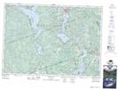
Maps showing Lentz Landing, Renfrew, Ontario
Lentz Landing is a Marine navigation feature located in Renfrew, Ontario and has an elevation of 300 meters.
- Latitude: 45° 18' 3'' North (decimal: 45.3008333)
- Longitude: 77° 35' 19'' West (decimal: -77.5886111)
- Topography Feature Category: Marine navigation feature
- Geographical Feature: Landing
- Canadian Province/Territory: Ontario
- Elevation: 300 meters
- Location: Renfrew
- Atlas of Canada Locator Map: Lentz Landing
- GPS Coordinate Locator Map: Lentz Landing Lat/Long
Lentz Landing NTS Map Sheets