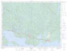
Maps showing Rainbow Falls Provincial Park, Thunder Bay, Ontario
Rainbow Falls Provincial Park is a Conservation area located in Thunder Bay, Ontario and has an elevation of 286 meters.
- Latitude: 48° 50' 51'' North (decimal: 48.8474999)
- Longitude: 87° 23' 32'' West (decimal: -87.3922222)
- Topography Feature Category: Conservation area
- Geographical Feature: Provincial Park
- Canadian Province/Territory: Ontario
- Elevation: 286 meters
- Location: Thunder Bay
- Atlas of Canada Locator Map: Rainbow Falls Provincial Park
- GPS Coordinate Locator Map: Rainbow Falls Provincial Park Lat/Long
Rainbow Falls Provincial Park NTS Map Sheets