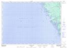
Maps showing Nares Ledge, Parry Sound, Ontario
Nares Ledge is a Shoal located in Parry Sound, Ontario.
- Latitude: 45° 33' 55'' North (decimal: 45.5652777)
- Longitude: 80° 31' 9'' West (decimal: -80.5191666)
- Topography Feature Category: Shoal
- Geographical Feature: Ledge
- Canadian Province/Territory: Ontario
- Location: Parry Sound
- Atlas of Canada Locator Map: Nares Ledge
- GPS Coordinate Locator Map: Nares Ledge Lat/Long
Nares Ledge NTS Map Sheets