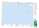
Maps showing Presqu'ile Islands Wilderness Area, Northumberland, Ontario
Presqu'ile Islands Wilderness Area is a Conservation area located in Northumberland, Ontario.
- Latitude: 43° 58' 58'' North (decimal: 43.9827777)
- Longitude: 77° 44' 25'' West (decimal: -77.7402777)
- Topography Feature Category: Conservation area
- Geographical Feature: Wilderness Area
- Canadian Province/Territory: Ontario
- Location: Northumberland
- Atlas of Canada Locator Map: Presqu'ile Islands Wilderness Area
- GPS Coordinate Locator Map: Presqu'ile Islands Wilderness Area Lat/Long