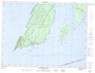
Maps showing Sleeping Giant Wilderness Area, Thunder Bay, Ontario
Sleeping Giant Wilderness Area is a Conservation area located in Thunder Bay, Ontario.
- Latitude: 48° 19' 15'' North (decimal: 48.3208333)
- Longitude: 88° 55' 13'' West (decimal: -88.9202777)
- Topography Feature Category: Conservation area
- Geographical Feature: Wilderness Area
- Canadian Province/Territory: Ontario
- Location: Thunder Bay
- Atlas of Canada Locator Map: Sleeping Giant Wilderness Area
- GPS Coordinate Locator Map: Sleeping Giant Wilderness Area Lat/Long
Sleeping Giant Wilderness Area NTS Map Sheets