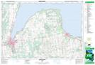
Maps showing Christie Beach Conservation Area, Ontario
Christie Beach Conservation Area is a Conservation area located in Ontario and has an elevation of 188 meters.
- Latitude: 44° 36' North (decimal: 44.5999999)
- Longitude: 80° 31' West (decimal: -80.5167000)
- Topography Feature Category: Conservation area
- Geographical Feature: Conservation Area
- Canadian Province/Territory: Ontario
- Elevation: 188 meters
- Atlas of Canada Locator Map: Christie Beach Conservation Area
- GPS Coordinate Locator Map: Christie Beach Conservation Area Lat/Long
Christie Beach Conservation Area NTS Map Sheets