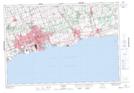
Maps showing Lynde Shores Conservation Area, Ontario
Lynde Shores Conservation Area is a Conservation area located in Ontario and has an elevation of 75 meters.
- Latitude: 43° 51' North (decimal: 43.8500000)
- Longitude: 78° 58' West (decimal: -78.9667000)
- Topography Feature Category: Conservation area
- Geographical Feature: Conservation Area
- Canadian Province/Territory: Ontario
- Elevation: 75 meters
- Atlas of Canada Locator Map: Lynde Shores Conservation Area
- GPS Coordinate Locator Map: Lynde Shores Conservation Area Lat/Long