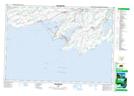
Maps showing Milford Mill Pond Conservation Area, Ontario
Milford Mill Pond Conservation Area is a Conservation area located in Ontario and has an elevation of 87 meters.
- Latitude: 43° 56' North (decimal: 43.9332999)
- Longitude: 77° 6' West (decimal: -77.0999999)
- Topography Feature Category: Conservation area
- Geographical Feature: Conservation Area
- Canadian Province/Territory: Ontario
- Elevation: 87 meters
- Atlas of Canada Locator Map: Milford Mill Pond Conservation Area
- GPS Coordinate Locator Map: Milford Mill Pond Conservation Area Lat/Long
Milford Mill Pond Conservation Area NTS Map Sheets