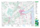
Maps showing New Lowell Conservation Area, Ontario
New Lowell Conservation Area is a Conservation area located in Ontario and has an elevation of 213 meters.
- Latitude: 44° 21' North (decimal: 44.3500000)
- Longitude: 79° 59' West (decimal: -79.9833000)
- Topography Feature Category: Conservation area
- Geographical Feature: Conservation Area
- Canadian Province/Territory: Ontario
- Elevation: 213 meters
- Atlas of Canada Locator Map: New Lowell Conservation Area
- GPS Coordinate Locator Map: New Lowell Conservation Area Lat/Long