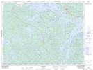
Maps showing Butler Lake Provincial Nature Reserve, Kenora, Ontario
Butler Lake Provincial Nature Reserve is a Conservation area located in Kenora, Ontario and has an elevation of 396 meters.
- Latitude: 49° 41' 41'' North (decimal: 49.6947222)
- Longitude: 92° 43' 12'' West (decimal: -92.7200000)
- Topography Feature Category: Conservation area
- Geographical Feature: Provincial Nature Reserve
- Canadian Province/Territory: Ontario
- Elevation: 396 meters
- Location: Kenora
- Atlas of Canada Locator Map: Butler Lake Provincial Nature Reserve
- GPS Coordinate Locator Map: Butler Lake Provincial Nature Reserve Lat/Long