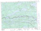
Maps showing Castle Creek Provincial Nature Reserve, Thunder Bay, Ontario
Castle Creek Provincial Nature Reserve is a Conservation area located in Thunder Bay, Ontario.
- Latitude: 48° 11' 41'' North (decimal: 48.1947221)
- Longitude: 90° 3' 42'' West (decimal: -90.0616666)
- Topography Feature Category: Conservation area
- Geographical Feature: Provincial Nature Reserve
- Canadian Province/Territory: Ontario
- Location: Thunder Bay
- Atlas of Canada Locator Map: Castle Creek Provincial Nature Reserve
- GPS Coordinate Locator Map: Castle Creek Provincial Nature Reserve Lat/Long