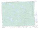
Maps showing Matawin River Provincial Nature Reserve, Thunder Bay, Ontario
Matawin River Provincial Nature Reserve is a Conservation area located in Thunder Bay, Ontario and has an elevation of 466 meters.
- Latitude: 48° 23' 21'' North (decimal: 48.3891666)
- Longitude: 90° 10' 11'' West (decimal: -90.1697221)
- Topography Feature Category: Conservation area
- Geographical Feature: Provincial Nature Reserve
- Canadian Province/Territory: Ontario
- Elevation: 466 meters
- Location: Thunder Bay
- Atlas of Canada Locator Map: Matawin River Provincial Nature Reserve
- GPS Coordinate Locator Map: Matawin River Provincial Nature Reserve Lat/Long