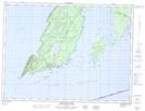
Maps showing Porphyry Island Provincial Nature Reserve, Thunder Bay, Ontario
Porphyry Island Provincial Nature Reserve is a Conservation area located in Thunder Bay, Ontario.
- Latitude: 48° 21' 4'' North (decimal: 48.351111)
- Longitude: 88° 38' 7'' West (decimal: -88.6352776)
- Topography Feature Category: Conservation area
- Geographical Feature: Provincial Nature Reserve
- Canadian Province/Territory: Ontario
- Location: Thunder Bay
- Atlas of Canada Locator Map: Porphyry Island Provincial Nature Reserve
- GPS Coordinate Locator Map: Porphyry Island Provincial Nature Reserve Lat/Long
Porphyry Island Provincial Nature Reserve NTS Map Sheets