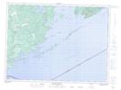
Maps showing Thompson Island Provincial Nature Reserve, Thunder Bay, Ontario
Thompson Island Provincial Nature Reserve is a Conservation area located in Thunder Bay, Ontario.
- Latitude: 48° 9' 46'' North (decimal: 48.1627777)
- Longitude: 89° 10' 24'' West (decimal: -89.1733333)
- Topography Feature Category: Conservation area
- Geographical Feature: Provincial Nature Reserve
- Canadian Province/Territory: Ontario
- Location: Thunder Bay
- Atlas of Canada Locator Map: Thompson Island Provincial Nature Reserve
- GPS Coordinate Locator Map: Thompson Island Provincial Nature Reserve Lat/Long
Thompson Island Provincial Nature Reserve NTS Map Sheets