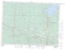
Maps showing Silver Falls Provincial Park, Thunder Bay, Ontario
Silver Falls Provincial Park is a Conservation area located in Thunder Bay, Ontario.
- Latitude: 48° 41' 12'' North (decimal: 48.686671)
- Longitude: 89° 36' 27'' West (decimal: -89.607389)
- Topography Feature Category: Conservation area
- Geographical Feature: Provincial Park
- Canadian Province/Territory: Ontario
- Location: Thunder Bay
- Atlas of Canada Locator Map: Silver Falls Provincial Park
- GPS Coordinate Locator Map: Silver Falls Provincial Park Lat/Long
Silver Falls Provincial Park NTS Map Sheets