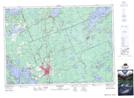
Maps showing Greey Point, Muskoka, Ontario
Greey Point is a Cape located in Muskoka, Ontario and has an elevation of 241 meters.
- Latitude: 45° 1' 00'' North (decimal: 45.0166666)
- Longitude: 79° 24' 50'' West (decimal: -79.4138888)
- Topography Feature Category: Cape
- Geographical Feature: Point
- Canadian Province/Territory: Ontario
- Elevation: 241 meters
- Location: Muskoka
- Atlas of Canada Locator Map: Greey Point
- GPS Coordinate Locator Map: Greey Point Lat/Long
Greey Point NTS Map Sheets