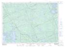
Maps showing South Magnetawan, Parry Sound, Ontario
South Magnetawan is a Unincorporated area located in Parry Sound, Ontario and has an elevation of 209 meters.
- Latitude: 45° 43' 3'' North (decimal: 45.7174999)
- Longitude: 80° 15' 44'' West (decimal: -80.2622222)
- Topography Feature Category: Unincorporated area
- Geographical Feature: Locality
- Canadian Province/Territory: Ontario
- Elevation: 209 meters
- Location: Parry Sound
- Atlas of Canada Locator Map: South Magnetawan
- GPS Coordinate Locator Map: South Magnetawan Lat/Long
South Magnetawan NTS Map Sheets