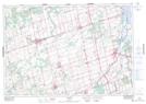
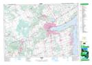
Maps showing Champ de tir et champ de manoeuvre Borden, Simcoe, Ontario
Champ de tir et champ de manoeuvre Borden is a Military area located in Simcoe, Ontario.
- Latitude: 44° 16' 52'' North (decimal: 44.2810999)
- Longitude: 79° 55' 5'' West (decimal: -79.9181000)
- Topography Feature Category: Military area
- Geographical Feature: C.M.F.C.
- Canadian Province/Territory: Ontario
- Location: Simcoe
- Atlas of Canada Locator Map: Champ de tir et champ de manoeuvre Borden
- GPS Coordinate Locator Map: Champ de tir et champ de manoeuvre Borden Lat/Long
Champ de tir et champ de manoeuvre Borden NTS Map Sheets