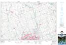
Maps showing Champ de manoeuvre Fanshawe Dam, Middlesex, Ontario
Champ de manoeuvre Fanshawe Dam is a Military area located in Middlesex, Ontario.
- Latitude: 43° 6' North (decimal: 43.0999999)
- Longitude: 81° 10' West (decimal: -81.1667000)
- Topography Feature Category: Military area
- Geographical Feature: C.M.F.C.
- Canadian Province/Territory: Ontario
- Location: Middlesex
- Atlas of Canada Locator Map: Champ de manoeuvre Fanshawe Dam
- GPS Coordinate Locator Map: Champ de manoeuvre Fanshawe Dam Lat/Long