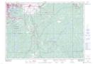
Maps showing Champ de manoeuvre Sudbury, Sudbury, Ontario
Champ de manoeuvre Sudbury is a Military area located in Sudbury, Ontario and has an elevation of 285 meters.
- Latitude: 46° 23' North (decimal: 46.3833000)
- Longitude: 80° 56' West (decimal: -80.9332999)
- Topography Feature Category: Military area
- Geographical Feature: C.M.F.C.
- Canadian Province/Territory: Ontario
- Elevation: 285 meters
- Location: Sudbury
- Atlas of Canada Locator Map: Champ de manoeuvre Sudbury
- GPS Coordinate Locator Map: Champ de manoeuvre Sudbury Lat/Long