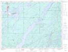
Maps showing Geraldton Training Area, Thunder Bay, Ontario
Geraldton Training Area is a Military area located in Thunder Bay, Ontario.
- Latitude: 49° 45' North (decimal: 49.7500000)
- Longitude: 86° 57' West (decimal: -86.9500000)
- Topography Feature Category: Military area
- Geographical Feature: C.F.T.A.
- Canadian Province/Territory: Ontario
- Location: Thunder Bay
- Atlas of Canada Locator Map: Geraldton Training Area
- GPS Coordinate Locator Map: Geraldton Training Area Lat/Long