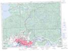
Maps showing Champ de manoeuvre Korah, Algoma, Ontario
Champ de manoeuvre Korah is a Military area located in Algoma, Ontario and has an elevation of 276 meters.
- Latitude: 46° 34' 9'' North (decimal: 46.5691999)
- Longitude: 84° 23' 10'' West (decimal: -84.3860999)
- Topography Feature Category: Military area
- Geographical Feature: C.M.F.C.
- Canadian Province/Territory: Ontario
- Elevation: 276 meters
- Location: Algoma
- Atlas of Canada Locator Map: Champ de manoeuvre Korah
- GPS Coordinate Locator Map: Champ de manoeuvre Korah Lat/Long
Champ de manoeuvre Korah NTS Map Sheets