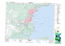
Maps showing Mount McKay Range, Thunder Bay, Ontario
Mount McKay Range is a Military area located in Thunder Bay, Ontario.
- Latitude: 48° 20' 59'' North (decimal: 48.3497222)
- Longitude: 89° 17' 28'' West (decimal: -89.2911111)
- Topography Feature Category: Military area
- Geographical Feature: C.F.T.A.
- Canadian Province/Territory: Ontario
- Location: Thunder Bay
- Atlas of Canada Locator Map: Mount McKay Range
- GPS Coordinate Locator Map: Mount McKay Range Lat/Long
Mount McKay Range NTS Map Sheets