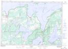
Maps showing Cathedral Rock, Manitoulin, Ontario
Cathedral Rock is a Mountain located in Manitoulin, Ontario.
- Latitude: 45° 48' 46'' North (decimal: 45.8127777)
- Longitude: 82° 14' 39'' West (decimal: -82.2441666)
- Topography Feature Category: Mountain
- Geographical Feature: Rock
- Canadian Province/Territory: Ontario
- Location: Manitoulin
- Atlas of Canada Locator Map: Cathedral Rock
- GPS Coordinate Locator Map: Cathedral Rock Lat/Long