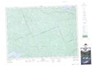
Maps showing Deermeadow Creek, Renfrew, Ontario
Deermeadow Creek is a River located in Renfrew, Ontario and has an elevation of 284 meters.
- Latitude: 46° 11' 36'' North (decimal: 46.1933333)
- Longitude: 78° 16' 51'' West (decimal: -78.2808333)
- Topography Feature Category: River
- Geographical Feature: Creek
- Canadian Province/Territory: Ontario
- Elevation: 284 meters
- Location: Renfrew
- Atlas of Canada Locator Map: Deermeadow Creek
- GPS Coordinate Locator Map: Deermeadow Creek Lat/Long