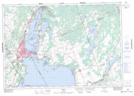
Maps showing Harry's Corner, Ontario, Ontario
Harry's Corner is a Unincorporated area located in Ontario, Ontario and has an elevation of 224 meters.
- Latitude: 44° 35' 5'' North (decimal: 44.5847222)
- Longitude: 79° 17' 52'' West (decimal: -79.2977777)
- Topography Feature Category: Unincorporated area
- Geographical Feature: Locality
- Canadian Province/Territory: Ontario
- Elevation: 224 meters
- Location: Ontario
- Atlas of Canada Locator Map: Harry's Corner
- GPS Coordinate Locator Map: Harry's Corner Lat/Long
Harry's Corner NTS Map Sheets