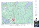
Maps showing Rockwood Island, Muskoka, Ontario
Rockwood Island is a Island located in Muskoka, Ontario.
- Latitude: 45° 1' 29'' North (decimal: 45.0247222)
- Longitude: 79° 25' 42'' West (decimal: -79.4283333)
- Topography Feature Category: Island
- Geographical Feature: Island
- Canadian Province/Territory: Ontario
- Location: Muskoka
- Atlas of Canada Locator Map: Rockwood Island
- GPS Coordinate Locator Map: Rockwood Island Lat/Long
Rockwood Island NTS Map Sheets